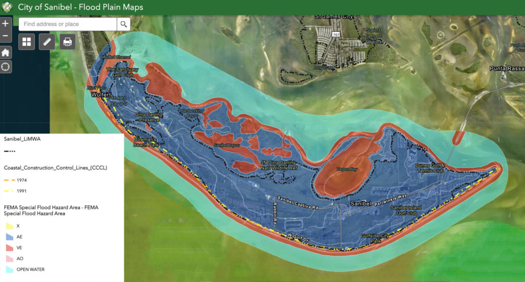
On November 17, 2022, the new FEMA Flood Insurance Rate Map became effective, which updated the Flood Maps on Sanibel Island.
Note: The map update is not related to Hurricane Ian, but rather a result of the RISK Map Study initiated by FEMA in 2013. Click here for the interactive version of the Sanibel Flood Zone Map shown below.
About FEMA Flood Maps
Flood maps show a community’s risk of flooding via floodplain boundaries, flood zoning, and base flood elevation information. These maps are used to determine flood insurance requirements and policy costs.
The maps are periodically updated since flood hazards change over time due to erosion, new construction, community development, weather events, and more. Plus, newer technology allows for more accurate data and analysis. It takes several years to complete a new study, draft new maps, and undergo an appeal and resolution period before the new maps finally become effective.
Click here to learn more about Flood Maps & Flood Zones on FEMA’s website.
2022 Flood Map Revisions
The flood maps on Sanibel Island that became effective on November 17, 2022, include a new Coastal A Zone and a new area referred to as the Limit of Moderate Wave Action (LiMWA).
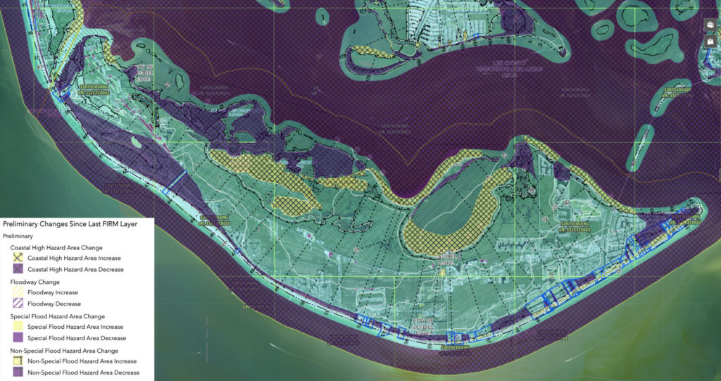
In the image below, the areas in purple indicate a decrease in floodplain hazard risk, and the areas in yellow indicate an increase. This image was taken from the “Flood Map Changes Viewer Map” linked here. The map allows you to conduct a side-by-side comparison of revisions for a particular property. Click here for instructions on how to complete a comparison.
Flood Related Resources
FEMA’s website, FloodSmart.gov has a wealth of information regarding flood risk, flood insurance, and even flood insurance claims that we encourage you to browse and save.
Check out our other related blog posts:


